EO-WIDGET
Area Monitoring System Service
Satellite information services supporting the CAP
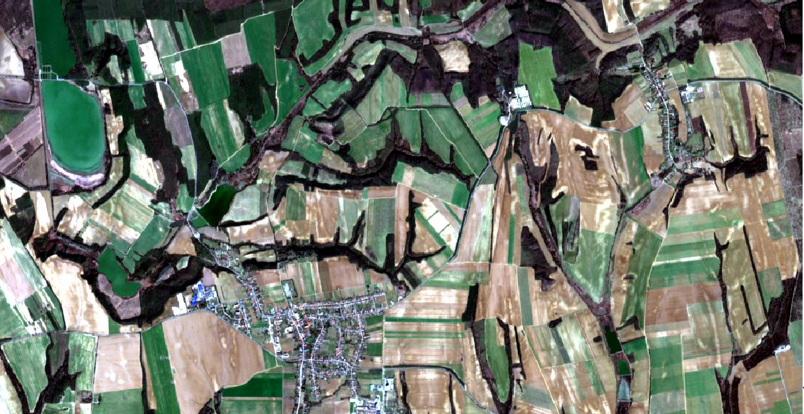
Checks by Monitoring and Area Monitoring System
The provision of Earth observation-based monitoring solutions, through Data as a Service and visualization by widget-based Apps, enables Paying Agencies to get fast access to reliable information required for right-adjusted, customized monitoring, expert judgements and policy reporting obligations.
Marketplace mechanisms and transparent service subscription plans are offered for solid procurements from commercial suppliers of
CAP monitoring products and services.

Data as a Service
Managed satellite data capturing, high-throughput pre-processing, and on-demand generation of CAP satellite signal-based monitoring products with comprehensive territorial and seasonal coverages

Widgets
Easy to re-use and integrate
mini-applications providing visualization access to delivered, monitoring products and related quality assessments / expert judgments

Hosting
Secured cloud workspaces and hosted tools, individualized per Paying Agency, for handling of declarations, configurations and products

Marketplace
One-stop shop and subscription plans for vendor offerings to Paying Agencies, including self-service quote generation, ordering, billing and monitoring product activation

Benefits
Paying Agencies benefit from the provision of farmer declaration eligibility Checks by Monitoring as a Service (CbM-aaS) i.e. all information derived from multi-temporal satellite observations and required for administration and control are made retrievable online via Web interfaces for integration with the IACS. The service is designed to allow configuration and deployment of individual CAP strategies and its performance is enforced via commercial Service Level Agreement (SLA) subscriptions.
Products
Cross-provider monitoring product standardization is and important element of the service concept and covers: Signals, Vegetation Status Indicator, Markers, Cultivated Crop Type, Grassland Mowing, Harvest Detection, Winter Catch Crop, and many more.
Agri Web App
For Paying Agencies, the burden of satellite data processing is completely eliminated as this is outsourced to the industrial contractor who performs the job within a managed cloud environment. Monitoring products are made accessible via REST APIs.
Collaboration
Services are based on open, modular and interoperable workflows encouraging different providers to connect in value chains. Direct suppliers to Paying Agencies can concentrate on local requirements and customise the customer-facing components.
The team
GeoVille Information Systems and Data Processing GmbH, an international operating EO & geo-information company, and EOX IT Services GmbH,
a geospatial software engineering and consulting company, are teaming up to provide EO-derived information for green and productive agriculture in Europe.

Get in touch with us
GeoVille Information Systems and Data Processing GmbH
Email: kolitzus(at)geoville.com
EOX
IT Services GmbH
Email: gerhard.triebnig(at)eox.at
About EO-WIDGET
Project co-funded by the
European Space Agency
Coordination company
GeoVille Information Systems and Data Processing GmbH
Sparkassenplatz 2, AT-6020 Innsbruck
